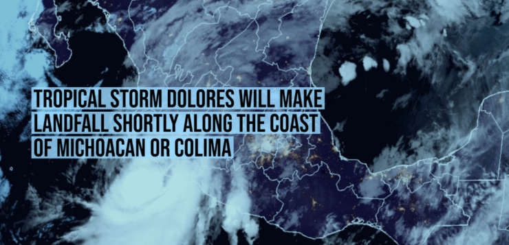
Mérida, Yucatán, (June 19, 2021).- Tropical storm Dolores, which formed this Friday, June 18th, in waters of the Mexican Pacific coast, is coming closer to the Mexican shores, causing heavy rainfall and strong winds in the west and south of the country, reported the Meteorological Service National (SMN).
“The center of tropical storm Dolores remains south of the coast of Michoacán,” SMN said in a statement.
The cloud bands of this system “produce extraordinarily strong rains, intense gusts of wind, and waves of 2 to 4 meters high in states of the west and south of the Mexican territory.
In its latest report, the Mexican Meteorological Service indicated that the cyclone was located 235 kilometers south-southwest of Lázaro Cárdenas, Michoacán, and 395 km south-southeast of Manzanillo, Colima.
It is moving northwest at 11 kilometers per hour and registers sustained winds of 75 kilometers per hour and gusts of 95 kilometers per hour.
“These rains could generate an increase in the levels of rivers and streams, overflows, mudslides and floods in low areas of land,” said the agency.
According to the forecast, on Saturday the tropical storm will not gain strength and will remain with that status, and on Sunday it will weaken to low remaining pressure, although the trajectory indicates that it will gradually advance northward and make landfall on Saturday afternoon in the state of Jalisco.
Due to this, the SMN, in coordination with the National Hurricane Center, maintains a surveillance zone for tropical storm winds from Lázaro Cárdenas, Michoacán, to Escuinapa, Sinaloa.
The 2021 rainy and tropical cyclone season began on May 15 and is expected to end on November 30th.
At the moment, cyclones Andrés, Blanca and Carlos have formed.
The Yucatan Times
Newsroom

